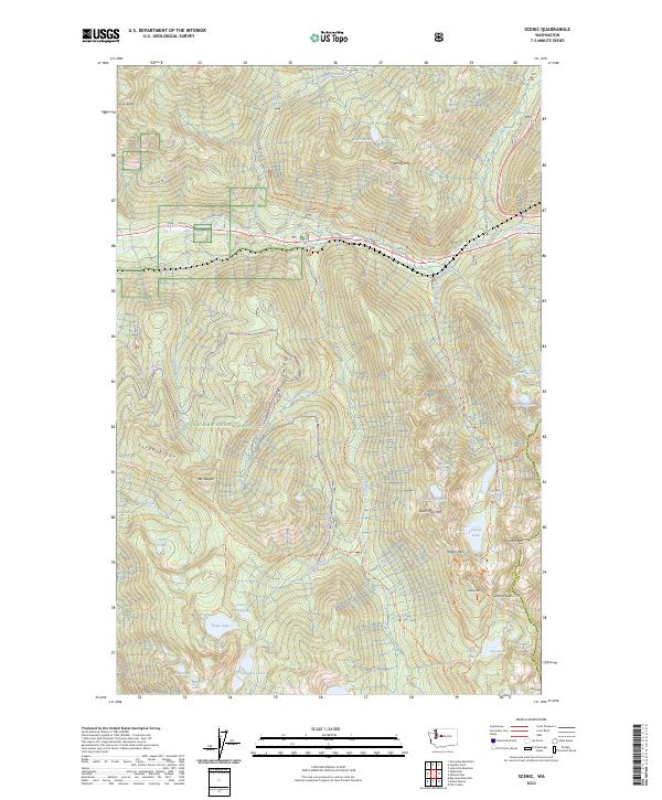
2023 Map of Scenic
USGS Topo · Published 2023About this map
Deception Falls and Alpine Falls mark the steep descent of the Tye River as it carves through this high-elevation wilderness. The landscape is defined by the legacy of early transcontinental transportation, featuring the original route of the Old Cascade Hwy and the Iron Goat Trl, which follows the historic Great Northern Railway grade. These corridor-focused features contrast with the protected reaches of the Wild Sky Wilderness to the north and the Alpine Lakes Wilderness to the south.
Find a feature on this map
58 named features on this map. Tap any name to fly to it.
Don’t see what you’re looking for? This feature index may not catch every label — zoom into the map to look around manually.
Map Details
Editions of this 2023 Scenic Map
This is the sole edition of this map. No revisions or reprints were ever made.
Other maps of this area

1902 · Skykomish
USGS Topo · 1:125,000

1905 · Skykomish
USGS Topo · 1:125,000

1957 · Wenatchee
USGS Topo · 1:250,000

1965 · Captain Point
USGS Topo · 1:24,000

1965 · Evergreen Mtn
USGS Topo · 1:24,000

1965 · Stevens Pass
USGS Topo · 1:24,000

1965 · Mount Daniel
USGS Topo · 1:24,000

1965 · Skykomish
USGS Topo · 1:24,000
1965 · Big Snow Mtn
USGS Topo · 1:24,000
1965 · Scenic
USGS Topo · 1:24,000