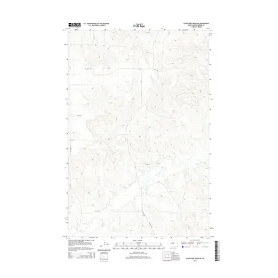
2014 Map of Schaffner Creek NE
USGS Topo · Published 2014About this map
The Knife River meanders across the southern landscape of this Mercer County region, joined by smaller tributaries including Gold Cr and Elm Cr. This 2014 survey documents a predominantly rural section of North Dakota where the terrain is marked by a network of sectional roads and county routes such as Cr-7 and Cr-5. The grid-like arrangement of local infrastructure, featuring named thoroughfares like 73th St SW and 77th Ave SW, reveals the enduring influence of the Public Land Survey System on modern navigation and land ownership. The map provides a clear view of the water drainage patterns through the creek beds, showing how these natural features intersect with the established road network in a landscape largely dedicated to agricultural and open-country uses.
Find a feature on this map
15 named features on this map. Tap any name to fly to it.
Don’t see what you’re looking for? This feature index may not catch every label — zoom into the map to look around manually.
Map Details
Editions of this 2014 Schaffner Creek NE Map
This is the sole edition of this map. No revisions or reprints were ever made.
Other maps of this area

1953 · Watford City
USGS Topo · 1:250,000

1954 · McClusky
USGS Topo · 1:250,000

1957 · Watford City
USGS Topo · 1:250,000

1958 · McClusky
USGS Topo · 1:250,000

1967 · Watford City
USGS Topo · 1:250,000

1968 · Medicine Butte
USGS Topo · 1:24,000

1969 · Zap
USGS Topo · 1:24,000
1972 · Medicine Butte SW
USGS Topo · 1:24,000

1973 · Schaffner Creek NE
USGS Topo · 1:24,000

1973 · Willow Creek West
USGS Topo · 1:24,000