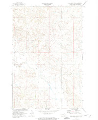
1972 Map of Medicine Butte SW
USGS Topo · Published 1973About this map
Elm Creek and Beaver Cr meander through the high plains of Mercer County in this 1972 survey conducted by the U.S. Geological Survey in cooperation with the North Dakota Water Commission. The landscape is characterized by its drainage patterns and water management features, including several instances of a Flowing Well located across the townships. While primarily a rural expanse of the Great Plains, small-scale industrial activity is evidenced by the presence of a Gravel Pit. The map captures the region's topographical transition through detailed contouring, providing a clear record of the watershed and land divisions as they existed before modern agricultural and infrastructure changes altered the surface drainage of this portion of North Dakota.
Find a feature on this map
6 named features on this map. Tap any name to fly to it.
Don’t see what you’re looking for? This feature index may not catch every label — zoom into the map to look around manually.
Map Details
Editions of this 1972 Medicine Butte SW Map
This is the sole edition of this map. No revisions or reprints were ever made.
Other maps of this area

1953 · Dickinson
USGS Topo · 1:250,000

1953 · Watford City
USGS Topo · 1:250,000

1954 · Bismarck
USGS Topo · 1:250,000

1954 · McClusky
USGS Topo · 1:250,000

1957 · Dickinson
USGS Topo · 1:250,000

1957 · Watford City
USGS Topo · 1:250,000

1958 · Bismarck
USGS Topo · 1:250,000

1958 · McClusky
USGS Topo · 1:250,000

1967 · Watford City
USGS Topo · 1:250,000

1968 · Medicine Butte NE
USGS Topo · 1:24,000