
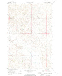
1973 Map of Schaffner Creek NE
USGS Topo · Published 1977About this map
The Knife River meanders through this Mercer County landscape, shaping a wide valley floor marked by several distinct loops and oxbows. In this part of the Missouri Plateau during the early 1970s, the terrain is defined by the drainage network of Gold Creek and numerous upland Spring sites. A Gaging Sta along the riverbank indicates the importance of monitoring water levels in this prairie environment, where seasonal flows were vital for ranching and agriculture. The presence of Landing Strips in the southern portion of the quadrangle suggests the reliance on small aircraft for navigating these expansive rural distances. Aside from the occasional Elm stand, the map reveals a largely open, high-plains topography, capturing the character of the North Dakota backcountry before modern large-scale development changed the local footprint.
Find a feature on this map
7 named features on this map. Tap any name to fly to it.
Don’t see what you’re looking for? This feature index may not catch every label — zoom into the map to look around manually.
Map Details
Editions of this 1973 Schaffner Creek NE Map
This is the sole edition of this map. No revisions or reprints were ever made.
Other maps of this area

1953 · Watford City
USGS Topo · 1:250,000

1954 · McClusky
USGS Topo · 1:250,000

1957 · Watford City
USGS Topo · 1:250,000

1958 · McClusky
USGS Topo · 1:250,000

1967 · Watford City
USGS Topo · 1:250,000

1968 · Medicine Butte
USGS Topo · 1:24,000

1969 · Zap
USGS Topo · 1:24,000
1972 · Medicine Butte SW
USGS Topo · 1:24,000

1973 · Willow Creek West
USGS Topo · 1:24,000

1973 · Schaffner Creek
USGS Topo · 1:24,000