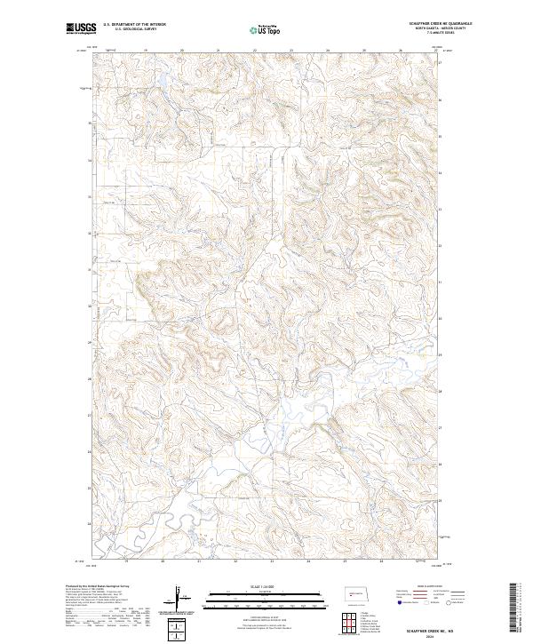
2024 Map of Schaffner Creek NE
USGS Topo · Published 2024About this map
The Knife River meanders across this Mercer County landscape, joined by its local tributaries Gold Creek and Elm Creek. The terrain is defined by a dense network of coulees and ridges typical of the North Dakota grasslands, punctuated by a strict grid of section lines and local thoroughfares. This rural expanse is crisscrossed by established county routes like Co Rd 5 and Co Rd 7, providing access to the various townships within the Public Land Survey System, including t143n r90w. The map reveals the quiet, agricultural character of the region, where gravel roads like 13th St Sw and 73rd Ave Sw trace the high ground and valley edges. There are no major settlements shown, emphasizing the open ranching and farming nature of the Missouri Plateau at this location.
Find a feature on this map
21 named features on this map. Tap any name to fly to it.
Don’t see what you’re looking for? This feature index may not catch every label — zoom into the map to look around manually.
Map Details
Editions of this 2024 Schaffner Creek NE Map
This is the sole edition of this map. No revisions or reprints were ever made.
Other maps of this area

1953 · Watford City
USGS Topo · 1:250,000

1954 · McClusky
USGS Topo · 1:250,000

1957 · Watford City
USGS Topo · 1:250,000

1958 · McClusky
USGS Topo · 1:250,000

1967 · Watford City
USGS Topo · 1:250,000

1968 · Medicine Butte
USGS Topo · 1:24,000

1969 · Zap
USGS Topo · 1:24,000
1972 · Medicine Butte SW
USGS Topo · 1:24,000

1973 · Schaffner Creek NE
USGS Topo · 1:24,000

1973 · Willow Creek West
USGS Topo · 1:24,000