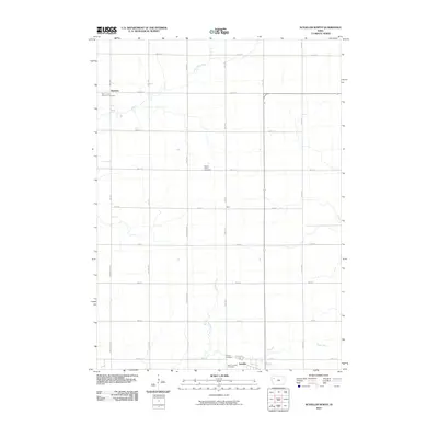
2010 Map of Schaller North
USGS Topo · Published 2010About this map
Schaller anchors the southern edge of this Sac County landscape, serving as a primary point of reference for the surrounding agricultural region. The map documents a structured grid of rural infrastructure, where long-established cemetery sites provide essential landmarks for genealogists and local historians. Notable among these are Saint John's Lutheran Cemetery in the northwest and the clustered Schaller Cemetery and Saint Joseph Cemetery near the southern township line. Between these sites, the terrain is defined by the subtle drainage of the Little Maple River, Halfway Creek, and the Boyer River. Small settlements and locales like Hanover and Blain are situated along the extensive network of county roads, such as 820th St and Armstrong Ave, which divide the fertile Iowa prairie into precise sections.
Find a feature on this map
30 named features on this map. Tap any name to fly to it.
Don’t see what you’re looking for? This feature index may not catch every label — zoom into the map to look around manually.
Map Details
Editions of this 2010 Schaller North Map
This is the sole edition of this map. No revisions or reprints were ever made.
Other maps of this area

1954 · Fort Dodge
USGS Topo · 1:250,000

1957 · Fort Dodge
USGS Topo · 1:250,000

1958 · Fort Dodge
USGS Topo · 1:250,000

1967 · Ida Grove NW
USGS Topo · 1:24,000

1969 · Aurelia
USGS Topo · 1:24,000

1969 · Galva
USGS Topo · 1:24,000

1979 · Lakeside
USGS Topo · 1:24,000

1979 · Storm Lake
USGS Topo · 1:24,000

1979 · Alta
USGS Topo · 1:24,000

1979 · Schaller North
USGS Topo · 1:24,000