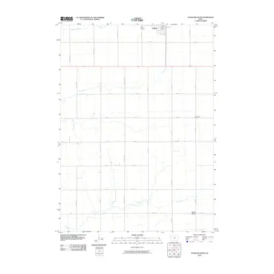
2010 Map of Schaller South
USGS Topo · Published 2010About this map
Schaller sits at the northern edge of this Sac County landscape, a community defined by its rigid grid of section-line roads and prairie drainage. The town's local services are anchored by the Schaller Post Office, while the surrounding countryside is partitioned by a meticulous network of gravel routes like Bettin Ave and 210th St. This 2010 survey illustrates the deep-seated agricultural geometry of western Iowa, where family legacy and land use are etched into the map through locations such as Saint Joseph Cemetery and Cook Center Cemetery. The terrain is subtly carved by a series of south-flowing waterways, including Halfway Creek, Silver Creek, and South Silver Creek, which eventually give way to the winding course of Elk Creek in the south. These intermittent streams provide the only deviation from the relentless checkerboard of rural avenues.
Find a feature on this map
28 named features on this map. Tap any name to fly to it.
Don’t see what you’re looking for? This feature index may not catch every label — zoom into the map to look around manually.
Map Details
Editions of this 2010 Schaller South Map
This is the sole edition of this map. No revisions or reprints were ever made.
Other maps of this area

1954 · Fort Dodge
USGS Topo · 1:250,000

1957 · Fort Dodge
USGS Topo · 1:250,000

1958 · Fort Dodge
USGS Topo · 1:250,000

1967 · Ida Grove
USGS Topo · 1:24,000

1967 · Ida Grove NW
USGS Topo · 1:24,000

1969 · Galva
USGS Topo · 1:24,000

1979 · Lakeside
USGS Topo · 1:24,000

1979 · Schaller North
USGS Topo · 1:24,000

1980 · Odebolt East
USGS Topo · 1:24,000

1980 · Early
USGS Topo · 1:24,000