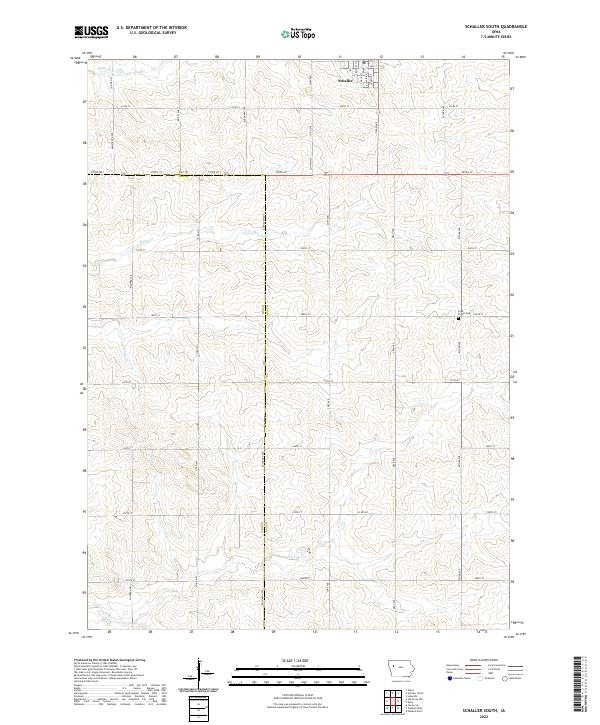
2022 Map of Schaller South
USGS Topo · Published 2022About this map
Schaller anchors the northern edge of this agricultural landscape, where the town's street grid, including S Main St and S Dundas St, gives way to the expansive section-line road system of the rural interior. The terrain is defined by the winding paths of Silver Creek and Elk Creek, which drain the undulating fields. A significant jurisdictional boundary separates Sac County and Ida County, running north-south along Buchanan Ave before shifting. For local historians and genealogists, the Cook Center Cem stands as a focal point in the eastern portion of the map near Esther Ave. The map illustrates a strictly organized rural township structure, typical of this part of Iowa, where farmsteads are linked by a precise network of routes like Co Rd M31 and 250th St.
Find a feature on this map
43 named features on this map. Tap any name to fly to it.
Don’t see what you’re looking for? This feature index may not catch every label — zoom into the map to look around manually.
Map Details
Editions of this 2022 Schaller South Map
This is the sole edition of this map. No revisions or reprints were ever made.
Other maps of this area

1954 · Fort Dodge
USGS Topo · 1:250,000

1957 · Fort Dodge
USGS Topo · 1:250,000

1958 · Fort Dodge
USGS Topo · 1:250,000

1967 · Ida Grove
USGS Topo · 1:24,000

1967 · Ida Grove NW
USGS Topo · 1:24,000

1969 · Galva
USGS Topo · 1:24,000

1979 · Lakeside
USGS Topo · 1:24,000

1979 · Schaller North
USGS Topo · 1:24,000

1980 · Odebolt East
USGS Topo · 1:24,000

1980 · Early
USGS Topo · 1:24,000