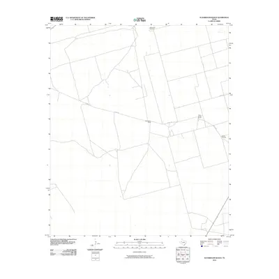
2010 Map of Scharbauer Ranch
USGS Topo · Published 2010About this map
Scharbauer Ranch and the nearby Old L Seven Ranch define the settlement pattern of this West Texas landscape, where large-scale ranching operations utilize a network of county roads to manage the arid terrain. The map illustrates the functional layout of the high plains, where water access remains the primary driver of habitation and infrastructure. Isolated landmarks like Stephenson Windmill and Falkner Windmill are crucial navigational and survival points across the expansive acreage. This 2010 survey by the U. S. Geological Survey shows a relatively sparse human footprint, with transportation primarily limited to unpaved routes such as Co Rd 4750 and Co Rd 2151, reflecting the region's continued dedication to cattle ranching and rural land use.
Find a feature on this map
8 named features on this map. Tap any name to fly to it.
Don’t see what you’re looking for? This feature index may not catch every label — zoom into the map to look around manually.
Map Details
Editions of this 2010 Scharbauer Ranch Map
This is the sole edition of this map. No revisions or reprints were ever made.
Other maps of this area

1954 · Hobbs
USGS Topo · 1:250,000

1958 · Hobbs
USGS Topo · 1:250,000

1966 · Wolcott Ranch
USGS Topo · 1:24,000

1966 · Flynt Ranch
USGS Topo · 1:24,000

1966 · Scharbauer Ranch
USGS Topo · 1:24,000

1966 · Bird Ranch
USGS Topo · 1:24,000

1970 · Patricia SW
USGS Topo · 1:24,000

1970 · Patricia
USGS Topo · 1:24,000

1970 · McKenzie Lake SE
USGS Topo · 1:24,000

1971 · Five Wells Ranch SE
USGS Topo · 1:24,000