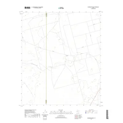
2019 Map of Scharbauer Ranch
USGS Topo · Published 2019About this map
Scharbauer Ranch anchors this West Texas landscape where the flat horizons of Andrews County meet the western edge of Martin County. The area is defined by the subtle topography of Mustang Draw, a drainage feature that winds through a region primarily dedicated to large-scale ranching and petroleum infrastructure. This 2019 survey illustrates the organized grid of rural life, with a network of secondary roads including Co RD 4750, Co RD 5000, and Co RD 2151 facilitating movement across the expansive terrain. The scarcity of named settlements highlights the isolated nature of the ranching operations here, where the named property serves as a primary landmark for the surrounding acreage.
Find a feature on this map
9 named features on this map. Tap any name to fly to it.
Don’t see what you’re looking for? This feature index may not catch every label — zoom into the map to look around manually.
Map Details
Editions of this 2019 Scharbauer Ranch Map
This is the sole edition of this map. No revisions or reprints were ever made.
Other maps of this area

1954 · Hobbs
USGS Topo · 1:250,000

1958 · Hobbs
USGS Topo · 1:250,000

1966 · Wolcott Ranch
USGS Topo · 1:24,000

1966 · Flynt Ranch
USGS Topo · 1:24,000

1966 · Scharbauer Ranch
USGS Topo · 1:24,000

1966 · Bird Ranch
USGS Topo · 1:24,000

1970 · Patricia SW
USGS Topo · 1:24,000

1970 · Patricia
USGS Topo · 1:24,000

1970 · McKenzie Lake SE
USGS Topo · 1:24,000

1971 · Five Wells Ranch SE
USGS Topo · 1:24,000