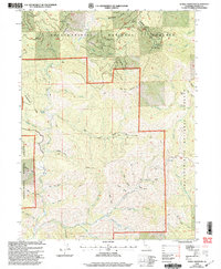
1998 Map of Schell Mountain
USGS Topo · Published 2003About this map
Gilroy Flat and Hall Cabin mark historical points of human presence in this high-elevation landscape within the Shasta-Trinity National Forests. Recorded in the late twentieth century, the map reveals a rugged terrain defined by significant ridgelines like Honeymoon Ridge and peaks including Schell Mountain and Wild Cow Mountain. The area is a complex watershed, where East Fork Clear Creek and its many tributaries, such as Red Hill Gulch and Canyon Hill Gulch, have carved deep drainages through the territory.
Find a feature on this map
48 named features on this map. Tap any name to fly to it.
Don’t see what you’re looking for? This feature index may not catch every label — zoom into the map to look around manually.
Map Details
Editions of this 1998 Schell Mountain Map
This is the sole edition of this map. No revisions or reprints were ever made.
Other maps of this area

1890 · Red Bluff
USGS Topo · 1:250,000

1894 · Red Bluff
USGS Topo · 1:250,000

1901 · Redding
USGS Topo · 1:125,000

1913 · Weaverville
USGS Topo · 1:125,000

1944 · Redding
USGS Topo · 1:62,500

1944 · French Gulch
USGS Topo · 1:62,500

1946 · Lamoine
USGS Topo · 1:62,500

1946 · Redding
USGS Topo · 1:62,500

1948 · French Gulch
USGS Topo · 1:62,500

1950 · Schell Mtn
USGS Topo · 1:62,500