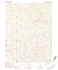
1982 Map of Schell Mtn
USGS Topo · Published 1982About this map
Shasta National Forest and Trinity National Forest converge in this high-elevation terrain, dominated by the prominent peaks of Schell Mountain and Wild Cow Mountain. The landscape is a complex drainage network of deep gulches and creek forks, including Buckbone Creek, Modesto Fork, and the North Fork Squaw Creek. Small clearings and seasonal outposts such as Schultz Sheep Camp, Gilroy Flat, and Hall Cabin indicate the area's history of high-country grazing and land management.
Find a feature on this map
42 named features on this map. Tap any name to fly to it.
Don’t see what you’re looking for? This feature index may not catch every label — zoom into the map to look around manually.
Map Details
Editions of this 1982 Schell Mtn Map
This is the sole edition of this map. No revisions or reprints were ever made.
Other maps of this area

1890 · Red Bluff
USGS Topo · 1:250,000

1894 · Red Bluff
USGS Topo · 1:250,000

1901 · Redding
USGS Topo · 1:125,000

1913 · Weaverville
USGS Topo · 1:125,000

1944 · Redding
USGS Topo · 1:62,500

1944 · French Gulch
USGS Topo · 1:62,500

1946 · Lamoine
USGS Topo · 1:62,500

1946 · Redding
USGS Topo · 1:62,500

1948 · French Gulch
USGS Topo · 1:62,500

1950 · Schell Mtn
USGS Topo · 1:62,500