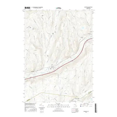
2016 Map of Schenevus
USGS Topo · Published 2016About this map
Schenevus serves as a central hub in this valley landscape, where the waters of Schenevus Creek and the transit lines of Interstate 88 and the railroad converge. The map documents a corridor of settlement that follows the water, stretching from Chaseville in the west through to Tuscan and Worcester in the northeast. This alignment of infrastructure highlights how the steep surrounding topography, including Dog Hill and Hooker Mtn, has historically funneled human activity into the narrow, fertile valleys.
Find a feature on this map
92 named features on this map. Tap any name to fly to it.
Don’t see what you’re looking for? This feature index may not catch every label — zoom into the map to look around manually.
Map Details
Editions of this 2016 Schenevus Map
This is the sole edition of this map. No revisions or reprints were ever made.
Other maps of this area

1904 · Richmondville
USGS Topo · 1:62,500

1904 · Hobart
USGS Topo · 1:62,500

1907 · Cooperstown
USGS Topo · 1:62,500

1909 · Cooperstown
USGS Topo · 1:62,500

1909 · Delhi
USGS Topo · 1:62,500

1911 · Delhi
USGS Topo · 1:62,500

1943 · Milford
USGS Topo · 1:24,000

1943 · South Valley
USGS Topo · 1:24,000

1943 · Westford
USGS Topo · 1:24,000

1943 · Charlotteville
USGS Topo · 1:24,000