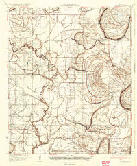
1934 Map of Schlater
USGS Topo · Published 1934About this map
Schlater and the surrounding Mississippi Delta landscape are defined by a complex network of meandering waterways and agricultural settlements in this 1930s survey. The Tallahatchie River snakes through the eastern territory, forming the dramatic Utah Bend, while the Quiver River and a labyrinth of bayous like Fighting Bayou and Rattlesnake Bayou drain the fertile lowlands. The area's social fabric is remarkably detailed, showing a high density of rural institutions such as the Rosenwald School, Sixteenth Section School, and numerous community anchors like Thankful Church and Zion Watch Church.
Find a feature on this map
82 named features on this map. Tap any name to fly to it.
Don’t see what you’re looking for? This feature index may not catch every label — zoom into the map to look around manually.
Map Details
Editions of this 1934 Schlater Map
2 editions found
Other maps of this area

1931 · Schlater
USGS Topo · 1:48,000

1931 · Sumner
USGS Topo · 1:48,000

1931 · Drew
USGS Topo · 1:48,000

1932 · Philipp
USGS Topo · 1:48,000

1934 · Cleveland
USGS Topo · 1:62,500

1934 · Schlater
USGS Topo · 1:62,500

1935 · Sumner
USGS Topo · 1:62,500

1935 · Mound Bayou
USGS Topo · 1:62,500

1935 · Philipp
USGS Topo · 1:62,500

1936 · Greenwood
USGS Topo · 1:62,500