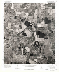
1974 Map of Schlater NW
USGS Topo · Published 1975About this map
Quiver River meanders across this orthophotoquad, serving as the central geographic anchor for a landscape dominated by the geometry of 1970s industrial agriculture. Produced from aerial photography captured in October 1974, this map reveals the precise layout of the Mississippi Delta's alluvial plain before modern changes. The imagery provides a clear view of the complex hydrology in the area, where the winding river is surrounded by vast, rectangular crop fields and distinct patches of remaining woodland. This specific visual record allows for the study of field drainage patterns and the relationship between the natural waterway and the intensive land use of the era, offering a level of physical detail often absent from traditional topographic line drawings.
Find a feature on this map
1 named feature on this map. Tap any name to fly to it.
Don’t see what you’re looking for? This feature index may not catch every label — zoom into the map to look around manually.
Map Details
Editions of this 1974 Schlater NW Map
This is the sole edition of this map. No revisions or reprints were ever made.
Other maps of this area

1931 · Schlater
USGS Topo · 1:48,000

1931 · Sumner
USGS Topo · 1:48,000

1931 · Drew
USGS Topo · 1:48,000

1934 · Cleveland
USGS Topo · 1:62,500

1934 · Schlater
USGS Topo · 1:62,500

1935 · Sumner
USGS Topo · 1:62,500

1935 · Mound Bayou
USGS Topo · 1:62,500

1939 · Schlater
USGS Topo · 1:62,500

1939 · Sumner
USGS Topo · 1:62,500

1940 · Cleveland
USGS Topo · 1:62,500