
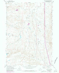
1961 Map of Schlict Draw
USGS Topo · Published 1965About this map
Gosney Ranch sits at the heart of this high plains landscape, where complex drainage systems define the territory of central Johnson County. The map captures the intricate network of the South Fork Crazy Woman Creek and its many tributaries, including Steel Creek, Springs Creek, and the namesake Schlict Draw. This 1961 field check records a ranching and resource-based economy, evidenced by the presence of a Gravel Pit, a Drill Hole, and a modern Radio Facility. To the north, the Old Railroad Grade cuts a linear path across the rolling terrain, marking a legacy of transportation that predates the mid-century mapping. To the south, the land rises sharply toward the prominent plateau of The Mesa, while water management is visible through infrastructure like Willow Glen Reservoir and Horn Creek Reservoir.
Find a feature on this map
23 named features on this map. Tap any name to fly to it.
Don’t see what you’re looking for? This feature index may not catch every label — zoom into the map to look around manually.
Map Details
Editions of this 1961 Schlict Draw Map
2 editions found
Other maps of this area

1900 · Fort McKinney
USGS Topo · 1:125,000

1903 · Fort McKinney
USGS Topo · 1:125,000

1955 · Sheridan
USGS Topo · 1:250,000

1955 · Arminto
USGS Topo · 1:250,000

1958 · Sheridan
USGS Topo · 1:250,000

1958 · Arminto
USGS Topo · 1:250,000

1961 · Dry Creek Reservoir
USGS Topo · 1:24,000

1961 · Antelope Draw
USGS Topo · 1:24,000

1961 · Hibbard Draw
USGS Topo · 1:24,000

1962 · Sheridan
USGS Topo · 1:250,000