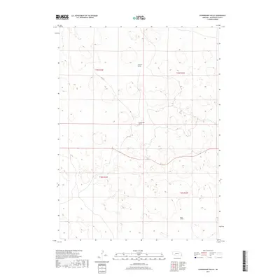
2017 Map of Schneringer Valley
USGS Topo · Published 2017About this map
Schneringer Valley and its surrounding sandhills topography define this portion of the Nebraska landscape, where drainage patterns and localized basins create a distinct series of valleys. The terrain is characterized by the presence of Dishpan Valley to the north and Dane Valley to the south, reflecting the traditional nomenclature of this ranching country. Transportation is limited to sparse corridors such as Suchy Rd, which traverses the central portion of the quadrangle. This 2017 survey reflects the enduring cadastral organization of the region, clearly delineating the boundaries of t19n r33w, t19n r32w, t18n r33w, and t18n r32w. The map serves as a record of land divisions and the minimal human infrastructure present in this specific section of the Nebraska Sandhills.
Find a feature on this map
8 named features on this map. Tap any name to fly to it.
Don’t see what you’re looking for? This feature index may not catch every label — zoom into the map to look around manually.
Map Details
Editions of this 2017 Schneringer Valley Map
This is the sole edition of this map. No revisions or reprints were ever made.
Other maps of this area

1898 · Paxton
USGS Topo · 1:125,000

1899 · North Platte
USGS Topo · 1:125,000

1901 · Paxton
USGS Topo · 1:125,000

1902 · North Platte
USGS Topo · 1:125,000

1949 · Wright Valley
USGS Topo · 1:62,500

1951 · Tryon
USGS Topo · 1:62,500

1951 · Wright Valley
USGS Topo · 1:62,500

1954 · North Platte
USGS Topo · 1:250,000

1956 · North Platte
USGS Topo · 1:250,000

1957 · North Platte
USGS Topo · 1:250,000