
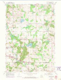
1954 Map of School Hill
USGS Topo · Published 1956About this map
Glacial kettle lakes and winding river valleys define the rural landscape of Manitowoc and Sheboygan counties during the mid-1950s. The Salvatorian Seminary and the village of School Hill serve as local anchors in a region characterized by a high density of one-room schoolhouses and country churches. The map captures a transition in agricultural life, where names like Hillside Grove Sch, Fountain Park Sch, and Maple Corner Sch represent the localized education system before mid-century consolidation. The southern portion of the sheet is dominated by the deeply carved valley of the Sheboygan River, where the settlement of Millhome sits near the crossing. The distribution of small cemeteries, such as Loretto Cem and Ucker Road Cem, alongside numerous Gravel Pits, reflects a community deeply tied to its physical geography and local materials.
Find a feature on this map
40 named features on this map. Tap any name to fly to it.
Don’t see what you’re looking for? This feature index may not catch every label — zoom into the map to look around manually.
Map Details
Editions of this 1954 School Hill Map
2 editions found
Other maps of this area

1954 · St. Wendel
USGS Topo · 1:24,000

1954 · Howards Grove
USGS Topo · 1:62,500

1954 · Howards Grove
USGS Topo · 1:24,000

1954 · Chilton
USGS Topo · 1:62,500

1954 · Reedsville
USGS Topo · 1:62,500

1954 · Franklin
USGS Topo · 1:24,000

1954 · Kiel
USGS Topo · 1:62,500

1954 · Milwaukee
USGS Topo · 1:250,000

1954 · Manitowoc
USGS Topo · 1:250,000

1955 · Green Bay
USGS Topo · 1:250,000