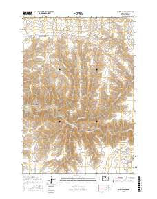
2017 Map of Schott Canyon
USGS Topo · Published 2017About this map
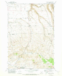
The high plateau of Gilliam County is defined by a dense network of drainages and ridges, centered on the deep cut of Schott Canyon. This arid landscape, surveyed in 2017, reveals a complex system of geographic nomenclature, with features like Yellow Dog Canyon, Coffin Canyon, and Cope Canyon carving through the terrain. The topography is anchored by prominent elevations including Zero Butte and Coyote Butte, while the Shoestring Ridge and Stebins Ridge provide natural boundaries between the many named hollows. The presence of Thirtymile Cr in the south and west marks a rare perennial water source in this dry region. Long-standing ranching and land use are evidenced by family-named routes such as Pattee Rd, Richmond Rd, and Wehrli Canyon Ln, which connect the remote ridges and canyon bottoms.
Find a feature on this map
39 named features on this map. Tap any name to fly to it.
Don’t see what you’re looking for? This feature index may not catch every label — zoom into the map to look around manually.
Map Details
Editions of this 2017 Schott Canyon Map
This is the sole edition of this map. No revisions or reprints were ever made.
Other maps of this area

1916 · Condon
USGS Topo · 1:125,000

1953 · The Dalles
USGS Topo · 1:250,000

1956 · The Dalles
USGS Topo · 1:250,000

1957 · The Dalles
USGS Topo · 1:250,000

1970 · Igo Butte
USGS Topo · 1:24,000
1970 · Schott Canyon
USGS Topo · 1:24,000
1970 · Chimney Springs
USGS Topo · 1:24,000

1970 · Condon
USGS Topo · 1:24,000
1970 · Buckhorn Canyon
USGS Topo · 1:24,000
1970 · Fossil North
USGS Topo · 1:24,000