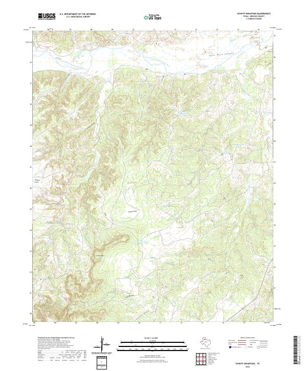
2022 Map of Schott Mountain
USGS Topo · Published 2022About this map
The Prairie Dog Town Fork Red River carves through the northern reaches of this Briscoe County landscape, defining the upper limits of the celebrated Palo Duro Canyon system. This 2022 survey documents a complex network of erosional features, from the broad expanse of Karnes Flat to the depths of Folley Canyon and Long Draw. The terrain is marked by essential water sources critical to the region's ranching heritage, including Wagon Wheel Tank, Minnow Spring, and Terry Spring. Standing as a prominent local landmark, Schott Mtn rises above the surrounding draws and tanks. The map provides a clear look at the sparsely developed territory south of the river, where Co RD 27 serves as one of the few improved routes through a country defined by named landmarks like Cleveland Draw and Folley Park.
Find a feature on this map
27 named features on this map. Tap any name to fly to it.
Don’t see what you’re looking for? This feature index may not catch every label — zoom into the map to look around manually.
Map Details
Editions of this 2022 Schott Mountain Map
This is the sole edition of this map. No revisions or reprints were ever made.
Other maps of this area

1954 · Plainview
USGS Topo · 1:250,000

1958 · Plainview
USGS Topo · 1:250,000

1960 · Indian Peak
USGS Topo · 1:62,500

1960 · Brice
USGS Topo · 1:62,500

1967 · Hay Lake
USGS Topo · 1:24,000

1967 · Turkey
USGS Topo · 1:24,000

1967 · Lake Theo
USGS Topo · 1:24,000
1976 · Indian Peak SW
USGS Topo · 1:24,000

1976 · Brice NW
USGS Topo · 1:24,000
1976 · Indian Peak NW
USGS Topo · 1:24,000