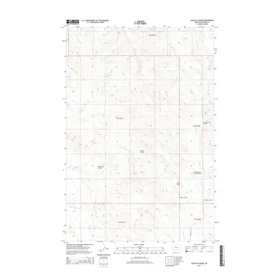
2014 Map of Schultz Coulee
USGS Topo · Published 2014About this map
Ice Cream Butte rises as a distinct landmark in this high-plains landscape within Rosebud County, where the topography is defined by a complex network of seasonal drainages and coulees. Water management in this semi-arid environment is evidenced by the presence of Big Reservoir and E Fork Reservoir, serving the cattle ranching operations that have long shaped the region's economy. The map traces the intricate paths of Schultz Coulee and Wagon Box Coulee as they carve through the terrain, eventually feeding into the larger watersheds of Cherry Cr and Horse Cr. Modern infrastructure is represented by Quarter Horse Rd, which provides one of the few formal routes through this expanse of range land, connecting isolated sections of the township grid across areas like t8n r41e.
Find a feature on this map
19 named features on this map. Tap any name to fly to it.
Don’t see what you’re looking for? This feature index may not catch every label — zoom into the map to look around manually.
Map Details
Editions of this 2014 Schultz Coulee Map
This is the sole edition of this map. No revisions or reprints were ever made.
Other maps of this area

1954 · Forsyth
USGS Topo · 1:250,000

1957 · Forsyth
USGS Topo · 1:250,000

1958 · Forsyth
USGS Topo · 1:250,000

1968 · Orinoco
USGS Topo · 1:24,000

1968 · Rosebud
USGS Topo · 1:24,000

1968 · Box Canyon Coulee
USGS Topo · 1:24,000

1968 · Forsyth
USGS Topo · 1:24,000

1968 · Schultz Coulee
USGS Topo · 1:24,000

1968 · Black Coulee
USGS Topo · 1:24,000

1969 · Wild Horse Pass
USGS Topo · 1:24,000