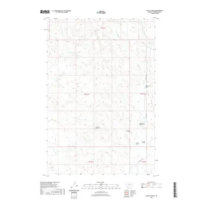
2020 Map of Schultz Coulee
USGS Topo · Published 2020About this map
Ice Cream Butte and the surrounding terrain of Rosebud County define this landscape of high plains drainage systems. The topography is dominated by a complex network of dry washes and ephemeral streams, including the central Wagon Box Coulee and Schultz Coulee. This 2020 map details a livestock and ranching environment where water management is critical, evidenced by Big Reservoir and East Fork Reservoir. The area is carved by several branches of Horse Creek, such as W Fork Horse Cr and E Fork Horse Cr, which flow through the northern sections of the quadrangle. For the historian or researcher, the map preserves traditional local names for natural features and spring-fed draws, including Black Buttes Spring Coulee and Hammerstrom Coulee, reflecting the generational naming conventions of Montana's rural backcountry.
Find a feature on this map
19 named features on this map. Tap any name to fly to it.
Don’t see what you’re looking for? This feature index may not catch every label — zoom into the map to look around manually.
Map Details
Editions of this 2020 Schultz Coulee Map
This is the sole edition of this map. No revisions or reprints were ever made.
Other maps of this area

1954 · Forsyth
USGS Topo · 1:250,000

1957 · Forsyth
USGS Topo · 1:250,000

1958 · Forsyth
USGS Topo · 1:250,000

1968 · Orinoco
USGS Topo · 1:24,000

1968 · Rosebud
USGS Topo · 1:24,000

1968 · Box Canyon Coulee
USGS Topo · 1:24,000

1968 · Forsyth
USGS Topo · 1:24,000

1968 · Schultz Coulee
USGS Topo · 1:24,000

1968 · Black Coulee
USGS Topo · 1:24,000

1969 · Wild Horse Pass
USGS Topo · 1:24,000