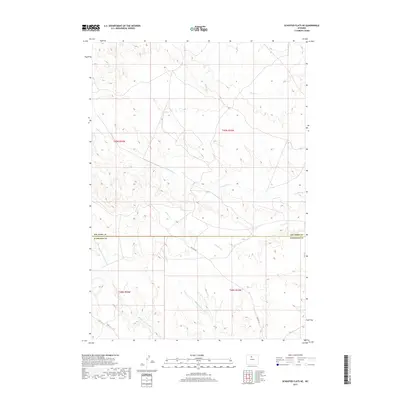
2017 Map of Schuster Flats NE
USGS Topo · Published 2017About this map
The boundary line between Big Horn and Washakie counties divides this high desert landscape, defined by a network of seasonal drainages and administrative sections. Arid topography is dissected by multiple ephemeral waterways, most notably the winding paths of Fivemile Cr and Sixmile Cr, which flow generally eastward toward the Bighorn River basin. Further south, the landscape is shaped by the headwaters of the Tenmile drainage system, including Middle Fork Tenmile Cr and the N Fork Tenmile Cr. Human imprint on the terrain is sparse, consisting primarily of the established Ten Mile Rd and a grid of secondary tracks used for land management and ranching access. This 2017 survey documents the modern state of these rangelands, where water access via features like Dobie Cr and Alamo Cr remains central to the region's geographical character.
Find a feature on this map
12 named features on this map. Tap any name to fly to it.
Don’t see what you’re looking for? This feature index may not catch every label — zoom into the map to look around manually.
Map Details
Editions of this 2017 Schuster Flats NE Map
This is the sole edition of this map. No revisions or reprints were ever made.
Other maps of this area

1951 · Schuster Flats NE
USGS Topo · 1:24,000

1951 · Schuster Flats
USGS Topo · 1:24,000

1951 · Schuster Flats NW
USGS Topo · 1:24,000

1951 · Schuster Flats SE
USGS Topo · 1:24,000

1955 · Cody
USGS Topo · 1:250,000

1955 · Sheridan
USGS Topo · 1:250,000

1958 · Cody
USGS Topo · 1:250,000

1958 · Sheridan
USGS Topo · 1:250,000

1960 · Manderson
USGS Topo · 1:24,000

1962 · Sheridan
USGS Topo · 1:250,000