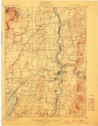
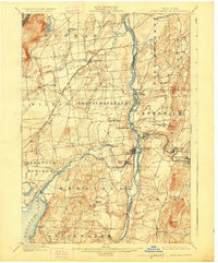
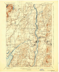
1900 Map of Schuylerville
USGS Topo · Published 1910About this map
The Hudson River corridor at the turn of the century serves as a vital artery of commerce and conflict, where the Champlain Canal traces the eastern bank through villages like Fort Miller and Thomson. This landscape is deeply shaped by its Revolutionary War heritage, anchored by the Saratoga Battlefield in the south and the prominent Battle Monument overlooking Schuylerville. The region’s industrial character is evident in the cluster of mill towns such as Victory Mills and Clarks Mills situated along the powerful descent of the Batten Kill and Fish Creek. Away from the river, the terrain rises toward Mt. McGregor and Bald Mountain, while local transport is facilitated by a complex rail network including the Delaware and Hudson R. R. and the Electric R. R. near the resort atmosphere of Saratoga Lake.
Find a feature on this map
64 named features on this map. Tap any name to fly to it.
Don’t see what you’re looking for? This feature index may not catch every label — zoom into the map to look around manually.
Map Details
Editions of this 1900 Schuylerville Map
7 editions found

Other maps of this area

1893 · Cohoes
USGS Topo · 1:62,500

1893 · Schenectady
USGS Topo · 1:62,500

1893 · Fort Ann
USGS Topo · 1:62,500

1895 · Cohoes
USGS Topo · 1:62,500

1895 · Cambridge
USGS Topo · 1:62,500

1895 · Fort Ann
USGS Topo · 1:62,500

1895 · Schenectady
USGS Topo · 1:62,500

1895 · Glens Falls
USGS Topo · 1:62,500

1897 · Glens Falls
USGS Topo · 1:62,500

1897 · Hoosick
USGS Topo · 1:62,500