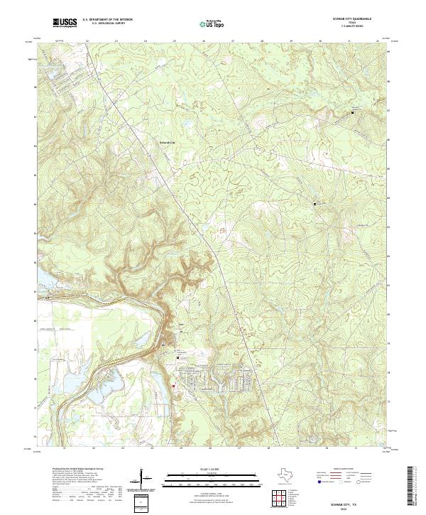
2022 Map of Schwab City
USGS Topo · Published 2022About this map
Schwab City and the neighboring community of Ace anchor this East Texas landscape where the Trinity River defines the border between Polk and San Jacinto counties. The river's meandering course creates a complex of oxbow lakes and wetlands, including Devils Lake, Gerlach Lake, and the curiously named Fish Scale Lake. Further inland, the terrain is defined by a dense network of tributaries such as Menard Cr and Isham Br, which cut through the timbered reaches of the Piney Woods. Local history is preserved in several small burial grounds, including the Menard Chapel Cem and the Blue Water Cem. The road network, including Oil Field Rd and Tram Rd, suggests the region's enduring reliance on natural resources. Residential growth is visible in the north near Forest Springs Lake, where contemporary street names like Forever Green and Thousand Oaks mark evolving subdivisions within the forest.
Find a feature on this map
96 named features on this map. Tap any name to fly to it.
Don’t see what you’re looking for? This feature index may not catch every label — zoom into the map to look around manually.
Map Details
Editions of this 2022 Schwab City Map
This is the sole edition of this map. No revisions or reprints were ever made.
Other maps of this area

1943 · Liberty
USGS Topo · 1:125,000

1954 · Beaumont
USGS Topo · 1:250,000

1955 · Saratoga
USGS Topo · 1:62,500

1955 · Rayburn
USGS Topo · 1:62,500

1957 · Beaumont
USGS Topo · 1:250,000

1958 · Livingston
USGS Topo · 1:62,500

1958 · Segno
USGS Topo · 1:62,500

1984 · Segno
USGS Topo · 1:24,000

1984 · Soda
USGS Topo · 1:24,000

1984 · Beaumont
USGS Topo · 1:250,000