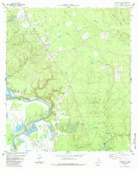
1984 Map of Schwab City
USGS Topo · Published 1984About this map
The Trinity River winds through the bottomlands of the Polk and San Jacinto county line, defining a landscape shaped by petroleum extraction and riparian systems. The northern portion of the map is dominated by the Livingston Oil Field, while the Schwab Oil Field sits further south near the community of Ace. This 1980s landscape shows a complex network of industrial infrastructure, with numerous Oil Wells and pipelines cutting across the piney woods and creek drainages.
Find a feature on this map
39 named features on this map. Tap any name to fly to it.
Don’t see what you’re looking for? This feature index may not catch every label — zoom into the map to look around manually.
Map Details
Editions of this 1984 Schwab City Map
This is the sole edition of this map. No revisions or reprints were ever made.
Other maps of this area

1943 · Liberty
USGS Topo · 1:125,000

1954 · Beaumont
USGS Topo · 1:250,000

1955 · Saratoga
USGS Topo · 1:62,500

1955 · Rayburn
USGS Topo · 1:62,500

1957 · Beaumont
USGS Topo · 1:250,000

1958 · Livingston
USGS Topo · 1:62,500

1958 · Segno
USGS Topo · 1:62,500

1984 · Segno
USGS Topo · 1:24,000

1984 · Soda
USGS Topo · 1:24,000

1984 · Beaumont
USGS Topo · 1:250,000