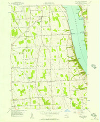
1956 Map of Scipio Center
USGS Topo · Published 1957About this map
The western shores of Owasco Lake define the eastern edge of this mid-century survey, where the Lehigh Valley railroad line follows the narrow terrace between the water and the rising uplands. This Cayuga County landscape is characterized by a dense network of country roads connecting small agricultural crossroads and family-named landmarks. The settlement pattern shows established hamlets like Scipio Center, Sherwood, and Fleming, each serving as local anchors for the surrounding rural townships.
Find a feature on this map
76 named features on this map. Tap any name to fly to it.
Don’t see what you’re looking for? This feature index may not catch every label — zoom into the map to look around manually.
Map Details
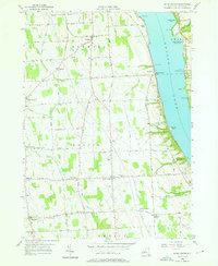
Editions of this 1956 Scipio Center Map
2 editions found
Other maps of this area

1898 · Moravia
USGS Topo · 1:62,500

1899 · Auburn
USGS Topo · 1:62,500

1899 · Skaneateles
USGS Topo · 1:62,500

1902 · Skaneateles
USGS Topo · 1:62,500

1902 · Moravia
USGS Topo · 1:62,500

1902 · Genoa
USGS Topo · 1:62,500

1902 · Auburn
USGS Topo · 1:62,500

1942 · Sheldrake
USGS Topo · 1:24,000

1942 · Genoa
USGS Topo · 1:24,000

1943 · Moravia
USGS Topo · 1:31,680