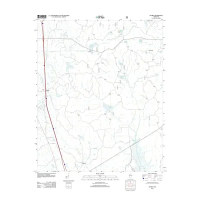
2012 Map of Scobey
USGS Topo · Published 2012About this map
Lake Tillatoba and its surrounding picnic area serve as a central landmark in this portion of Grenada County, Mississippi. The landscape is defined by an intricate network of creeks and small lakes, including Organ Creek, Simmons Creek, and Texas Lake. This 2012 survey illustrates the transition of the region from its historical rural roots to a modern landscape marked by established road systems like Old US Hwy 51 and Scobey Rd. Small settlements such as Scobey and Hardy remain key points of reference for local historians, while the Scobey Cem and Jehovah Cem provide vital links for genealogical research. The map's drainage patterns, featuring names like Cypress Creek and Riverdale Creek, highlight the water-rich topography that has shaped the area's development and land use over decades.
Find a feature on this map
55 named features on this map. Tap any name to fly to it.
Don’t see what you’re looking for? This feature index may not catch every label — zoom into the map to look around manually.
Map Details
Editions of this 2012 Scobey Map
This is the sole edition of this map. No revisions or reprints were ever made.
Other maps of this area

1953 · West Point
USGS Topo · 1:250,000

1954 · Grenada
USGS Topo · 1:62,500

1954 · Oakland
USGS Topo · 1:62,500

1954 · Water Valley
USGS Topo · 1:62,500

1955 · Water Valley
USGS Topo · 1:62,500

1955 · Coffeeville
USGS Topo · 1:62,500

1956 · Tupelo
USGS Topo · 1:250,000

1958 · Tupelo
USGS Topo · 1:250,000

1958 · West Point
USGS Topo · 1:250,000

1963 · West Point
USGS Topo · 1:250,000