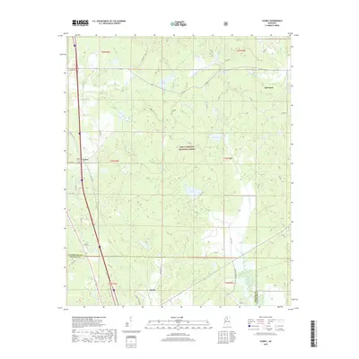
2018 Map of Scobey
USGS Topo · Published 2018About this map
The settlement of Scobey and the northern border of Hardy define this landscape along the Yalobusha and Grenada county line in north-central Mississippi. Much of the central and eastern terrain is preserved within the Holly Springs National Forest, a region characterized by a dense network of creeks including Simmons Creek, Organ Creek, and Riverdale Creek. Small water bodies like Lake Tillatoba, Organ Lake, and Texas Lake dot the forested hills, suggesting a landscape managed for conservation and local recreation.
Find a feature on this map
55 named features on this map. Tap any name to fly to it.
Don’t see what you’re looking for? This feature index may not catch every label — zoom into the map to look around manually.
Map Details
Editions of this 2018 Scobey Map
This is the sole edition of this map. No revisions or reprints were ever made.
Other maps of this area

1953 · West Point
USGS Topo · 1:250,000

1954 · Grenada
USGS Topo · 1:62,500

1954 · Oakland
USGS Topo · 1:62,500

1954 · Water Valley
USGS Topo · 1:62,500

1955 · Water Valley
USGS Topo · 1:62,500

1955 · Coffeeville
USGS Topo · 1:62,500

1956 · Tupelo
USGS Topo · 1:250,000

1958 · Tupelo
USGS Topo · 1:250,000

1958 · West Point
USGS Topo · 1:250,000

1963 · West Point
USGS Topo · 1:250,000