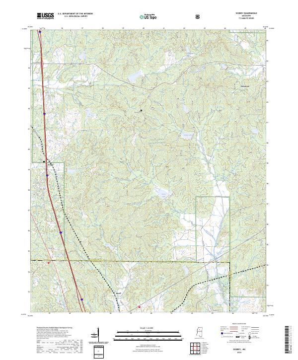
2024 Map of Scobey
USGS Topo · Published 2024About this map
Holly Springs National Forest dominates the rolling landscape of north-central Mississippi, where the boundaries of Yalobusha and Grenada counties meet. This modern survey shows a rural geography defined by the upper reaches of numerous waterways, including Simmons Creek, Davis Creek, and the winding Perry Creek. The small community of Scobey sits along the western edge, while Hardy serves as a southern anchor near the Grenada county line. The land is dotted with several small water bodies, such as Texas Lake and Organ Lake, reflecting the hydrological character of this forested region. For genealogists and local historians, the map identifies small markers of human presence like Jehovah Cem and the settlement at Gatewood. The transportation network is a grid of county roads, including Scobey Rd and Tillatoba Rd, which connect these isolated homesteads and timberlands to the larger region.
Find a feature on this map
57 named features on this map. Tap any name to fly to it.
Don’t see what you’re looking for? This feature index may not catch every label — zoom into the map to look around manually.
Map Details
Editions of this 2024 Scobey Map
This is the sole edition of this map. No revisions or reprints were ever made.
Other maps of this area

1953 · West Point
USGS Topo · 1:250,000

1954 · Grenada
USGS Topo · 1:62,500

1954 · Oakland
USGS Topo · 1:62,500

1954 · Water Valley
USGS Topo · 1:62,500

1955 · Water Valley
USGS Topo · 1:62,500

1955 · Coffeeville
USGS Topo · 1:62,500

1956 · Tupelo
USGS Topo · 1:250,000

1958 · Tupelo
USGS Topo · 1:250,000

1958 · West Point
USGS Topo · 1:250,000

1963 · West Point
USGS Topo · 1:250,000