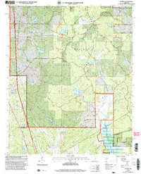
2000 Map of Scobey
USGS Topo · Published 2003About this map
Holly Springs National Forest dominates this landscape along the border of Yalobusha and Grenada Counties, where the land is defined by a dense network of creeks and small lakes. The Illinois Central Gulf railroad runs north-south through the western portion of the quadrangle, serving the settlements of Scobey and Hardy. These small communities grew around the rail corridor, which provided a vital link for the timber and agricultural resources of the surrounding hills.
Find a feature on this map
31 named features on this map. Tap any name to fly to it.
Don’t see what you’re looking for? This feature index may not catch every label — zoom into the map to look around manually.
Map Details
Editions of this 2000 Scobey Map
This is the sole edition of this map. No revisions or reprints were ever made.
Other maps of this area

1953 · West Point
USGS Topo · 1:250,000

1954 · Grenada
USGS Topo · 1:62,500

1954 · Oakland
USGS Topo · 1:62,500

1954 · Water Valley
USGS Topo · 1:62,500

1955 · Water Valley
USGS Topo · 1:62,500

1955 · Coffeeville
USGS Topo · 1:62,500

1956 · Tupelo
USGS Topo · 1:250,000

1958 · Tupelo
USGS Topo · 1:250,000

1958 · West Point
USGS Topo · 1:250,000

1963 · West Point
USGS Topo · 1:250,000