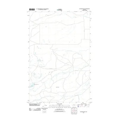
2011 Map of Scoffin Butte
USGS Topo · Published 2011About this map
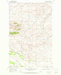
Scoffin Butte rises as a prominent landmark in this Teton County landscape, where the foothills of the Rockies meet the plains of northern Montana. The drainage patterns are the defining characteristic of this area, with Birch Creek marking the northern reaches and Sheep Creek winding through the central portion. Water management is a critical component of the local geography, evidenced by the Tedson Reservoir and the Tedson Reservoir Dam in the southwest, along with the B Canal and Dupuyer Creek to the east. The map illustrates a network of rural routes such as Swift Dam Rd and W Dupuyer Rd, which follow the natural contours of the various creek forks including North Fork Sheep Creek and Scoffin Creek. This 2011 survey documents a sparsely populated ranching or agricultural environment where infrastructure is secondary to the hydrological network.
Find a feature on this map
16 named features on this map. Tap any name to fly to it.
Don’t see what you’re looking for? This feature index may not catch every label — zoom into the map to look around manually.
Map Details
Editions of this 2011 Scoffin Butte Map
This is the sole edition of this map. No revisions or reprints were ever made.
Other maps of this area

1914 · Heart Butte
USGS Topo · 1:125,000

1918 · Heart Butte
USGS Topo · 1:125,000

1960 · Cut Bank
USGS Topo · 1:250,000

1963 · Cut Bank
USGS Topo · 1:250,000

1964 · Cut Bank
USGS Topo · 1:250,000

1968 · Fish Lake
USGS Topo · 1:24,000
1968 · Dupuyer West
USGS Topo · 1:24,000
1968 · Scoffin Butte
USGS Topo · 1:24,000
1968 · Volcano Reef
USGS Topo · 1:24,000
1968 · Blackleaf
USGS Topo · 1:24,000