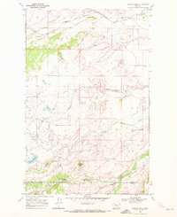
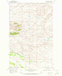
1968 Map of Scoffin Butte
USGS Topo · Published 1972About this map
The Blackfeet Indian Reservation Boundary marks the northern edge of this landscape, where the prairie begins its transition into the high plains of the Pondera and Teton County line. The terrain is defined by a complex network of seasonal drainages and permanent waterways, including the winding course of Birch Creek and the headwaters of Scoffin Creek. At the center of the survey stands Scoffin Butte, a prominent landmark overlooking a territory primarily used for ranching and water management, evidenced by the presence of the Tedson Reservoir and a nearby Gravel Pit. Local life in the late 1960s centered around isolated infrastructure such as the Terryahn School and the straight-line transit of Sevenmile Lane, illustrating the vast distances between rural Montana homesteads and essential community services.
Find a feature on this map
15 named features on this map. Tap any name to fly to it.
Don’t see what you’re looking for? This feature index may not catch every label — zoom into the map to look around manually.
Map Details
Editions of this 1968 Scoffin Butte Map
2 editions found
Other maps of this area

1914 · Heart Butte
USGS Topo · 1:125,000

1918 · Heart Butte
USGS Topo · 1:125,000

1960 · Cut Bank
USGS Topo · 1:250,000

1963 · Cut Bank
USGS Topo · 1:250,000

1964 · Cut Bank
USGS Topo · 1:250,000

1968 · Fish Lake
USGS Topo · 1:24,000
1968 · Dupuyer West
USGS Topo · 1:24,000
1968 · Volcano Reef
USGS Topo · 1:24,000
1968 · Blackleaf
USGS Topo · 1:24,000

1968 · Four Horns Lake
USGS Topo · 1:24,000