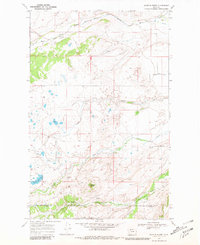
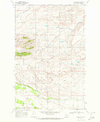
1968 Map of Scoffin Butte
USGS Topo · Published 1981About this map
The Blackfeet Indian Reservation Boundary (Indefinite) defines the northern reaches of this landscape, where the high plains meet the intricate drainages of the Rocky Mountain Front. Surveyed in the late 1960s, the terrain is characterized by a complex network of seasonal waters and managed irrigation, including Birch Creek and a prominent Canal in the northeast corner. The presence of the Terryann Sch near the center of the sheet indicates a dispersed rural community reliant on these water sources for ranching and agriculture.
Find a feature on this map
14 named features on this map. Tap any name to fly to it.
Don’t see what you’re looking for? This feature index may not catch every label — zoom into the map to look around manually.
Map Details
Editions of this 1968 Scoffin Butte Map
2 editions found
Other maps of this area

1914 · Heart Butte
USGS Topo · 1:125,000

1918 · Heart Butte
USGS Topo · 1:125,000

1960 · Cut Bank
USGS Topo · 1:250,000

1963 · Cut Bank
USGS Topo · 1:250,000

1964 · Cut Bank
USGS Topo · 1:250,000

1968 · Fish Lake
USGS Topo · 1:24,000
1968 · Dupuyer West
USGS Topo · 1:24,000
1968 · Scoffin Butte
USGS Topo · 1:24,000
1968 · Volcano Reef
USGS Topo · 1:24,000
1968 · Blackleaf
USGS Topo · 1:24,000