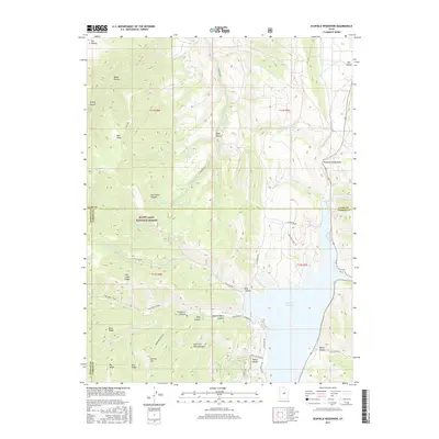
2017 Map of Scofield Reservoir
USGS Topo · Published 2017About this map
Scofield Reservoir dominates the eastern drainage of this 2017 survey, where the boundaries of Utah, Carbon, and Sanpete counties converge. The high-altitude landscape is defined by the western reaches of the Manti-Lasal National Forest, a terrain of steep ridges and deep canyons including Starvation Canyon and Kelly Canyon. Early land use is evident in family-named landmarks such as Andrew Dairy Canyon and Wife Canyon, suggesting the area's history of summer grazing and homesteading.
Find a feature on this map
55 named features on this map. Tap any name to fly to it.
Don’t see what you’re looking for? This feature index may not catch every label — zoom into the map to look around manually.
Map Details
Editions of this 2017 Scofield Reservoir Map
This is the sole edition of this map. No revisions or reprints were ever made.
Other maps of this area

1885 · Manti
USGS Topo · 1:250,000

1895 · Manti
USGS Topo · 1:250,000

1923 · Scofield
USGS Topo · 1:62,500

1925 · Scofield
USGS Topo · 1:62,500

1939 · Soldier Summit
USGS Topo · 1:62,500

1942 · Soldier Summit
USGS Topo · 1:62,500

1956 · Price
USGS Topo · 1:250,000

1960 · Price
USGS Topo · 1:250,000

1962 · Price
USGS Topo · 1:250,000

1965 · Fairview Lakes
USGS Topo · 1:24,000