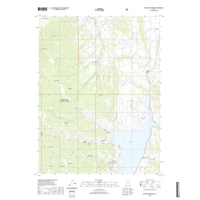
2020 Map of Scofield Reservoir
USGS Topo · Published 2020About this map
Scofield Reservoir dominates the eastern basin of this high-elevation landscape where Carbon, Utah, and Sanpete counties meet. Much of the western terrain is protected within the Manti-La Sal National Forest, characterized by a complex network of ridges and drainage systems including Bennion Ridge, Bear Ridge, and Fish Creek Ridge. This 2020 survey illustrates the modern recreation and transportation infrastructure supporting the reservoir, such as the Scofield Rec Area and Lakeshore Dr. Historical agricultural and grazing patterns are evident in the naming of features like Andrew Dairy Canyon and East Fork Dairy Canyon. The map also traces the Fish Creek Trail through the backcountry, following the path of Fish Creek as it winds toward the reservoir's western shore.
Find a feature on this map
52 named features on this map. Tap any name to fly to it.
Don’t see what you’re looking for? This feature index may not catch every label — zoom into the map to look around manually.
Map Details
Editions of this 2020 Scofield Reservoir Map
This is the sole edition of this map. No revisions or reprints were ever made.
Other maps of this area

1885 · Manti
USGS Topo · 1:250,000

1895 · Manti
USGS Topo · 1:250,000

1923 · Scofield
USGS Topo · 1:62,500

1925 · Scofield
USGS Topo · 1:62,500

1939 · Soldier Summit
USGS Topo · 1:62,500

1942 · Soldier Summit
USGS Topo · 1:62,500

1956 · Price
USGS Topo · 1:250,000

1960 · Price
USGS Topo · 1:250,000

1962 · Price
USGS Topo · 1:250,000

1965 · Fairview Lakes
USGS Topo · 1:24,000