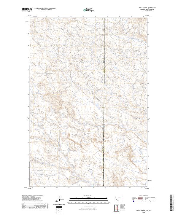
2024 Map of Scole School
USGS Topo · Published 2024About this map
The Colosseum stands as a prominent natural landmark in this high-plains landscape, where the border of Montana and North Dakota meets. This terrain is defined by the drainage networks of Big Gumbo Creek to the north and Soda Creek to the south, reflecting the sparse but resilient ranching and transport infrastructure of the modern West. The road network is strictly utilitarian, anchored by Little Beaver Rd and Webster Rd, which provide access through the rolling breaks and coulees. A distinct topographical shift occurs near Mud Creek, showing the complex erosion patterns common to the Badlands region. The map preserves the exact township and range lines, such as t130n r107w and t4n r62e, which continue to dictate property boundaries and land use in this borderland area between Fallon and Bowman counties.
Find a feature on this map
16 named features on this map. Tap any name to fly to it.
Don’t see what you’re looking for? This feature index may not catch every label — zoom into the map to look around manually.
Map Details
Editions of this 2024 Scole School Map
This is the sole edition of this map. No revisions or reprints were ever made.
Other maps of this area

1935 · Buffalo
USGS Topo · 1:125,000

1953 · Miles City
USGS Topo · 1:250,000

1953 · Dickinson
USGS Topo · 1:250,000

1954 · Lemmon
USGS Topo · 1:250,000

1954 · Ekalaka
USGS Topo · 1:250,000

1956 · Ekalaka
USGS Topo · 1:250,000

1957 · Dickinson
USGS Topo · 1:250,000

1957 · Lemmon
USGS Topo · 1:250,000

1957 · Miles City
USGS Topo · 1:250,000

1958 · Miles City
USGS Topo · 1:250,000