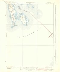
1940 Map of Sconticut Neck
USGS Topo · Published 1940About this map
Fairhaven coastal geography is defined by the prominent peninsula of Sconticut Neck and the nearby West Island, as they extend into the waters where Nasketucket Bay meets the larger Buzzards Bay. This 1940 edition, based on a 1936 survey by Roscoe Reeves and H.B.Smith, illustrates the landscape just before the significant mid-century residential expansion along the coast. The primary artery, Sconticut Neck Road, runs the length of the peninsula, providing the main access to the small clusters of development and the shoreline.
Find a feature on this map
27 named features on this map. Tap any name to fly to it.
Don’t see what you’re looking for? This feature index may not catch every label — zoom into the map to look around manually.
Map Details
Editions of this 1940 Sconticut Neck Map
3 editions found
Other maps of this area

1885 · New Bedford
USGS Topo · 1:62,500

1886 · Falmouth
USGS Topo · 1:62,500

1887 · Gay Head
USGS Topo · 1:62,500

1888 · New Bedford
USGS Topo · 1:62,500

1888 · Falmouth
USGS Topo · 1:62,500

1889 · Gay Head
USGS Topo · 1:62,500

1893 · Gay Head
USGS Topo · 1:62,500

1893 · Falmouth
USGS Topo · 1:62,500

1893 · New Bedford
USGS Topo · 1:62,500

1915 · Falmouth
USGS Topo · 1:62,500