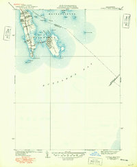
1940 Map of Sconticut Neck
USGS Topo · Published 1949About this map
Sconticut Neck extends into the waters of Buzzards Bay and Nasketucket Bay, defining the coastal character of southeastern Fairhaven during the mid-20th century. The landscape is dominated by tidal flats and low-lying coastal terrain, linked to the mainland and nearby West Island via the Sconticut Neck Road and a prominent Causeway. This 1940s-era survey captures the road network and settlement patterns before modern coastal development shifted the local footprint.
Find a feature on this map
28 named features on this map. Tap any name to fly to it.
Don’t see what you’re looking for? This feature index may not catch every label — zoom into the map to look around manually.
Map Details
Editions of this 1940 Sconticut Neck Map
3 editions found
Other maps of this area

1885 · New Bedford
USGS Topo · 1:62,500

1886 · Falmouth
USGS Topo · 1:62,500

1887 · Gay Head
USGS Topo · 1:62,500

1888 · New Bedford
USGS Topo · 1:62,500

1888 · Falmouth
USGS Topo · 1:62,500

1889 · Gay Head
USGS Topo · 1:62,500

1893 · Gay Head
USGS Topo · 1:62,500

1893 · Falmouth
USGS Topo · 1:62,500

1893 · New Bedford
USGS Topo · 1:62,500

1915 · Falmouth
USGS Topo · 1:62,500