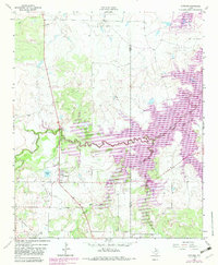
1963 Map of Scotland
USGS Topo · Published 1982About this map
The community of Scotland anchors this Archer County landscape, situated near the western edge of the developing Lake Arrowhead State Park. In the early 1960s, the region was defined by its primary industries: cattle and petroleum. Wide networks of oil wells dot the terrain, particularly within the South Vogtsberger-Strawn Oil Field and the Clay County Regular Oil Field to the east. The 1980s-era revisions, shown in purple, highlight the significant impact of the Little Wichita River impoundment, illustrating areas subject to controlled inundation that reshaped the local geography.
Find a feature on this map
19 named features on this map. Tap any name to fly to it.
Don’t see what you’re looking for? This feature index may not catch every label — zoom into the map to look around manually.
Map Details
Editions of this 1963 Scotland Map
2 editions found
Other maps of this area

1931 · Archer City
USGS Topo · 1:62,500

1954 · Wichita Falls
USGS Topo · 1:250,000

1956 · Sloop Creek
USGS Topo · 1:24,000

1956 · Lake Wichita
USGS Topo · 1:24,000

1957 · Wichita Falls East
USGS Topo · 1:62,500

1957 · Wichita Falls West
USGS Topo · 1:62,500

1958 · Wichita Falls
USGS Topo · 1:250,000

1962 · Windthorst
USGS Topo · 1:24,000

1963 · Deer Creek
USGS Topo · 1:24,000

1963 · Scotland
USGS Topo · 1:24,000