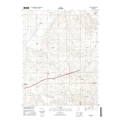
2016 Map of Scotland
USGS Topo · Published 2016About this map
Scotland and the adjacent town of Crane serve as focal points for this southwestern Indiana landscape, where the borders of Greene, Daviess, and Martin counties converge. The terrain is defined by a dense network of small waterways, including the winding White River and Richland Creek, which drain through distinctive lowlands like Bogard Bottoms and Maple Flats. The area is notably dense with family and community burial grounds, preserving names such as Ferguson Cem, Gilbreath Cem, and Ledgerwood Cem, which provide significant value for genealogical research in this rural corridor. Physical landmarks like Jolliff Rocks and Feutz Ridge interrupt the alluvial plains, while the presence of the Mount Nebo Church Cem and Mount Zion Ch suggests the enduring religious and social centers of these small townships. Transport is characterized by a mix of established state roads and numerous unnamed local routes and trails, such as Jeep Trl 4, reflecting the area's mixed agricultural and woodland use.
Find a feature on this map
80 named features on this map. Tap any name to fly to it.
Don’t see what you’re looking for? This feature index may not catch every label — zoom into the map to look around manually.
Map Details
Editions of this 2016 Scotland Map
This is the sole edition of this map. No revisions or reprints were ever made.
Other maps of this area

1908 · Bloomfield
USGS Topo · 1:62,500

1938 · Switz City
USGS Topo · 1:24,000

1943 · Lyons
USGS Topo · 1:24,000

1943 · Epsom
USGS Topo · 1:24,000

1947 · Switz City
USGS Topo · 1:24,000

1950 · Switz City
USGS Topo · 1:24,000

1950 · Odon
USGS Topo · 1:24,000

1951 · Bloomfield
USGS Topo · 1:24,000

1953 · Indianapolis
USGS Topo · 1:250,000

1956 · Indianapolis
USGS Topo · 1:250,000