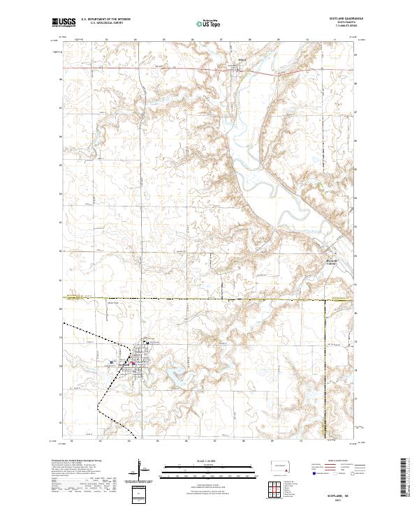
2021 Map of Scotland
USGS Topo · Published 2021About this map
The James River meanders through this portion of southeastern South Dakota, defining a landscape where the river's winding path intersects a rigid grid of section roads. The northern edge of the map features Olivet, home to the Hutchinson County Courthouse, while the settlement of Scotland anchors the southwestern quadrant. Scotland's street plan is clearly delineated, showing a concentration of community life around Main St, Washington St, and Burke Field.
Find a feature on this map
48 named features on this map. Tap any name to fly to it.
Don’t see what you’re looking for? This feature index may not catch every label — zoom into the map to look around manually.
Map Details
Editions of this 2021 Scotland Map
This is the sole edition of this map. No revisions or reprints were ever made.
Other maps of this area

1898 · Olivet
USGS Topo · 1:125,000

1955 · Sioux Falls
USGS Topo · 1:250,000

1957 · Tschetter Colony
USGS Topo · 1:24,000

1957 · Menno
USGS Topo · 1:24,000

1957 · Wolf Creek
USGS Topo · 1:24,000

1957 · Scotland
USGS Topo · 1:24,000

1958 · Sioux Falls
USGS Topo · 1:250,000

1978 · Tripp SE
USGS Topo · 1:24,000
1978 · Kloucek Lake
USGS Topo · 1:24,000
1978 · Lesterville
USGS Topo · 1:24,000