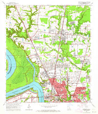
1963 Map of Scotlandville
USGS Topo · Published 1964About this map
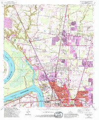
Scotlandville anchors this mid-century survey of the industrial and educational corridor north of Baton Rouge. The landscape is defined by the sharp transition from the Mississippi River and the low-lying Devils Swamp to the expanding suburban and institutional footprints of Southern University and Leland College. The riverbank itself reveals a history of navigation and labor with landings such as Mulatto Bend Landing and Belmont Landing, while the distinct Free Negro Point marks a prominent bend in the channel.
Find a feature on this map
81 named features on this map. Tap any name to fly to it.
Don’t see what you’re looking for? This feature index may not catch every label — zoom into the map to look around manually.
Map Details
Editions of this 1963 Scotlandville Map
5 editions found
Other maps of this area

1906 · Bayou Sara
USGS Topo · 1:125,000

1908 · Baton Rouge
USGS Topo · 1:62,500

1939 · Zachary
USGS Topo · 1:62,500

1939 · Baton Rouge
USGS Topo · 1:62,500

1940 · Grosse Tete
USGS Topo · 1:62,500

1953 · Baton Rouge West
USGS Topo · 1:24,000

1953 · Lobdell
USGS Topo · 1:24,000
1953 · Baton Rouge East
USGS Topo · 1:24,000

1953 · Comite
USGS Topo · 1:24,000

1954 · Zachary
USGS Topo · 1:24,000