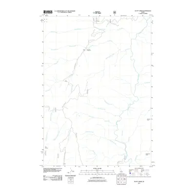
2011 Map of Scott Creek
USGS Topo · Published 2011About this map
The Deadwood River meanders through this portion of Valley County, carving a path through a landscape defined by high ridges and deep drainages. In this 2011 survey, the Scott Mountain Rd serves as the primary artery for navigating the area, winding its way past the Packsaddle Campground and ascending toward the high ground near Scott Mountain. This region is defined by its complex network of tributaries, including Ninemile Creek and Packsaddle Creek to the north, and the distinct forks of Middle Fork and East Fork Big Pine Creek to the south.
Find a feature on this map
27 named features on this map. Tap any name to fly to it.
Don’t see what you’re looking for? This feature index may not catch every label — zoom into the map to look around manually.
Map Details
Editions of this 2011 Scott Creek Map
This is the sole edition of this map. No revisions or reprints were ever made.
Other maps of this area

1909 · Garden Valley
USGS Topo · 1:125,000

1953 · Boiling Springs
USGS Topo · 1:62,500

1953 · Deadwood Reservoir
USGS Topo · 1:62,500

1957 · Challis
USGS Topo · 1:250,000

1959 · Garden Valley
USGS Topo · 1:62,500

1960 · Challis
USGS Topo · 1:250,000

1963 · Challis
USGS Topo · 1:250,000

1972 · Scott Creek
USGS Topo · 1:24,000
1972 · Miller Mtn West
USGS Topo · 1:24,000
1972 · Lowman
USGS Topo · 1:24,000