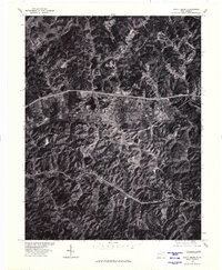
1977 Map of Scott Depot
USGS Topo · Published 1980About this map
Scott Depot and the surrounding hills of Putnam County are captured here in the late 1970s, showcasing a landscape defined by sharp topographical contrasts and emerging infrastructure. The settlement patterns of Teays and Washington follow the natural valley floors, bounded by the complex ridgelines of the Appalachian Plateau. This orthophoto provides a direct visual record of the region's mid-century expansion, documenting the path of Interstate 64 as it cut through the terrain to connect these historically rural communities. Visible landmarks such as Hickory Knob and the waters of Dickinson Lake anchor the geography, reflecting the balance between the established natural environment and the encroaching development of the era.
Find a feature on this map
5 named features on this map. Tap any name to fly to it.
Don’t see what you’re looking for? This feature index may not catch every label — zoom into the map to look around manually.
Map Details
Editions of this 1977 Scott Depot Map
This is the sole edition of this map. No revisions or reprints were ever made.
Other maps of this area

1892 · Huntington
USGS Topo · 1:125,000

1898 · Huntington
USGS Topo · 1:125,000

1899 · Charleston
USGS Topo · 1:125,000

1902 · Milton
USGS Topo · 1:62,500

1906 · Glenwood
USGS Topo · 1:62,500

1906 · Winfield
USGS Topo · 1:62,500

1908 · Glenwood
USGS Topo · 1:62,500

1908 · Winfield
USGS Topo · 1:62,500

1909 · Saint Albans
USGS Topo · 1:62,500

1931 · Saint Albans
USGS Topo · 1:62,500