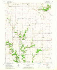
1965 Map of Scottland
USGS Topo · Published 1967About this map
The Illinois-Indiana state line bisects this 1965 survey, marking a transition between the rural landscapes of Edgar County and Vermillion County. The local economy of the mid-1960s is defined by the intersection of major rail lines, including the Chicago Milwaukee St Paul and Pacific and the Baltimore and Ohio, which serve small agricultural hubs like Scotland and West Dana. The terrain is characterized by the branching waters of Brouilletts Creek and Coal Creek, which create wooded breaks in the surrounding prairie.
Find a feature on this map
37 named features on this map. Tap any name to fly to it.
Don’t see what you’re looking for? This feature index may not catch every label — zoom into the map to look around manually.
Map Details
Editions of this 1965 Scottland Map
2 editions found
Other maps of this area

1947 · Ridge Farm
USGS Topo · 1:62,500

1947 · Paris
USGS Topo · 1:62,500

1949 · Paris
USGS Topo · 1:62,500

1951 · Clinton
USGS Topo · 1:24,000

1951 · Saint Bernice
USGS Topo · 1:24,000

1953 · Indianapolis
USGS Topo · 1:250,000

1955 · Humrick
USGS Topo · 1:24,000

1955 · Scottland
USGS Topo · 1:24,000

1955 · Dana
USGS Topo · 1:24,000
1955 · Newport
USGS Topo · 1:24,000