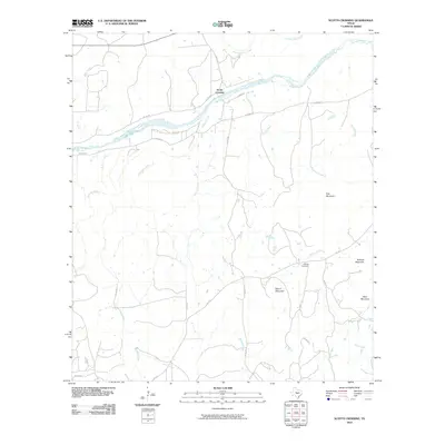
2010 Map of Scotts Crossing
USGS Topo · Published 2010About this map
Llano River defines the northern landscape of this Texas hill country quadrangle, where the small settlement of Scotts Crossing serves as a focal point near the riverbank. The terrain is characterized by numerous seasonal waterways, such as San Fernando Creek and Hickory Creek, which drain a region punctuated by distinct elevations like Hog Mountain and Blount Mountain.
Find a feature on this map
27 named features on this map. Tap any name to fly to it.
Don’t see what you’re looking for? This feature index may not catch every label — zoom into the map to look around manually.
Map Details
Editions of this 2010 Scotts Crossing Map
This is the sole edition of this map. No revisions or reprints were ever made.
Other maps of this area

1887 · Llano
USGS Topo · 1:125,000

1894 · Llano
USGS Topo · 1:125,000

1904 · Llano
USGS Topo · 1:125,000

1909 · Llano
USGS Topo · 1:125,000

1918 · Llano
USGS Topo · 1:125,000

1954 · Llano
USGS Topo · 1:250,000

1955 · Llano
USGS Topo · 1:250,000

1955 · Valley Spring
USGS Topo · 1:24,000
1955 · Llano North
USGS Topo · 1:24,000
1955 · Smoothingiron Mountain
USGS Topo · 1:24,000