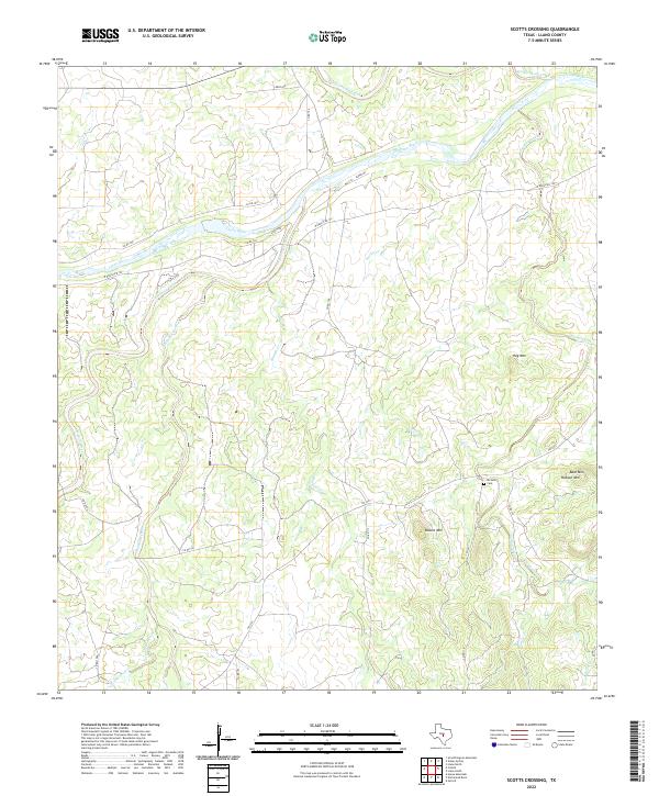
2022 Map of Scotts Crossing
USGS Topo · Published 2022About this map
The Llano River winds through this central Texas landscape, defining a terrain shaped by prominent granite uplifts and a complex network of seasonal drainage. Dominating the topography are several named peaks including Blount Mtn, Bear Mtn, and Hog Mtn, which rise above the surrounding ranch land. For local historians, the Six Mile Cem provides a specific point of genealogical interest in an area otherwise characterized by low-density rural development and winding ranch-to-market roads like FM 2323. Numerous tributaries, such as Hickory Creek, Bennett Cr, and San Fernando Creek, converge toward the river, illustrating the natural watershed patterns of Llano County. This study shows the enduring rural character of the region, where infrastructure like W Ranch Rd 152 follows the contours of the river valley.
Find a feature on this map
31 named features on this map. Tap any name to fly to it.
Don’t see what you’re looking for? This feature index may not catch every label — zoom into the map to look around manually.
Map Details
Editions of this 2022 Scotts Crossing Map
This is the sole edition of this map. No revisions or reprints were ever made.
Other maps of this area

1887 · Llano
USGS Topo · 1:125,000

1894 · Llano
USGS Topo · 1:125,000

1904 · Llano
USGS Topo · 1:125,000

1909 · Llano
USGS Topo · 1:125,000

1918 · Llano
USGS Topo · 1:125,000

1954 · Llano
USGS Topo · 1:250,000

1955 · Llano
USGS Topo · 1:250,000

1955 · Valley Spring
USGS Topo · 1:24,000
1955 · Llano North
USGS Topo · 1:24,000
1955 · Smoothingiron Mountain
USGS Topo · 1:24,000