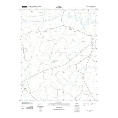
2010 Map of Scotts Hill
USGS Topo · Published 2010About this map
Scotts Hill serves as the primary community center in this western Tennessee landscape, where the terrain is defined by the winding course of the Beech River and its numerous tributaries. The map documents a dense network of family and community history, evidenced by more than a dozen named burial sites including Myracle Cemetery, Rosson Cemetery, and Hensley Cemetery. These sites are often found near prominent geographic landmarks like Bumpers Bluff or along historical transit corridors such as Old Stage Rd.
Find a feature on this map
77 named features on this map. Tap any name to fly to it.
Don’t see what you’re looking for? This feature index may not catch every label — zoom into the map to look around manually.
Map Details
Editions of this 2010 Scotts Hill Map
This is the sole edition of this map. No revisions or reprints were ever made.
Other maps of this area

1936 · Scotts Hill
USGS Topo · 1:24,000

1936 · Parsons
USGS Topo · 1:24,000

1936 · Thurman
USGS Topo · 1:24,000

1936 · Bath Springs
USGS Topo · 1:24,000

1936 · Sardis
USGS Topo · 1:24,000

1936 · Jeannette
USGS Topo · 1:24,000

1936 · Reagan
USGS Topo · 1:24,000

1936 · Perryville
USGS Topo · 1:24,000

1936 · Chesterfield
USGS Topo · 1:24,000

1949 · Perryville
USGS Topo · 1:24,000