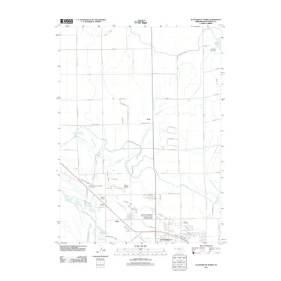
2011 Map of Scottsbluff North
USGS Topo · Published 2011About this map
Irrigation infrastructure and agricultural patterns define this portion of the Nebraska Panhandle, where the North Platte River flows through the southern reaches of the map. The landscape is structured by an extensive network of human-engineered waterways, including the Interstate Canal, Tri-State Canal, and Enterprise Canal, which support the farms and fields surrounding the city of Scottsbluff. To the north, Lake Alice and the Lake Alice Upper Dam represent significant water management features in this semi-arid region. Small localized settlements and siding names like Mintle, Covert, and Heldt appear alongside established sites such as the University of Nebraska Medical Center College of Nursing - West Nebraska Division. This survey captures the intersection of residential growth, exemplified by neighborhoods along 7th Ave and E 42nd St, and the persistent agricultural industry that remains the area's backbone.
Find a feature on this map
74 named features on this map. Tap any name to fly to it.
Don’t see what you’re looking for? This feature index may not catch every label — zoom into the map to look around manually.
Map Details
Editions of this 2011 Scottsbluff North Map
This is the sole edition of this map. No revisions or reprints were ever made.
Other maps of this area

1898 · Scotts Bluff
USGS Topo · 1:125,000

1899 · Whistle Creek
USGS Topo · 1:125,000

1954 · Scottsbluff
USGS Topo · 1:250,000

1955 · Alliance
USGS Topo · 1:250,000

1957 · Alliance
USGS Topo · 1:250,000

1958 · Alliance
USGS Topo · 1:250,000

1958 · Scottsbluff
USGS Topo · 1:250,000

1963 · Scottsbluff South
USGS Topo · 1:24,000

1963 · Mitchell
USGS Topo · 1:24,000

1963 · Scottsbluff North
USGS Topo · 1:24,000